
 As we got closer to Mono Lake and the town of Lee Vining, I kept seeing this spectacular mountain range in the distance to my right (west). I finally pulled over to take a picture of it. When we got to Lee Vining, we veered off to the highway on the right that took us into Yosemite's eastern entrance. Imagine my surprise to find myself driving right through that mountain range. It's called Tioga Pass. When we were in the Pass, I tried so hard to get a decent picture but it's simply impossible to put a frame around these cliffs and walls of rock. So I had to burn it into my brain. It's magnificent!!!
 We entered Yosemite and traveled through the eastern Tuolumne Meadows. Yeah, I know, "how the hell do you say that word?" Too-AHL-um-knee. The views were amazing.
 Looking west. Yosemite National Park, Tuolumne Meadows.
 We cut through Yosemite that day in order to get to our hotel in Mariposa, which is about 30 miles west of the Park. It's smack in the middle of gold country and the small highway that runs b/t Mariposa and Yosemite winds it's way down through a canyon which is dotted with old mines and suspension bridges, like this one.
 See the mine shaft on the hillside?
 Here's a travel tip: Don't visit Yosemite in August, in a drought year, and expect to see stunning waterfalls. When Brian and I went in April of 1992 w/ my folks, they were much better with the snow runoff.
 Yosemite Valley.
 We spent the next day in the park and we drove up to Glacier Point, high above the valley. There are no words to describe the wonder that is this view.

It's a looooong way down, innit?!
 As much as I enjoyed our road trip to Tahoe & Yosemite, I was eager to return to San Francisco for our next road trip down the coast. I really needed an ocean-fix after being in the hot & parched Sierra Nevada's. We came back to SF for one night before heading south down the Pacific Coast Highway and I'd selected the Seal Rock Inn as our hotel, as it is right on the water, above the Cliff House. It was an absolutely glorious evening and I shot TONS of pictures of the waves and the ruins of the old Sutro Baths. The Baths are a blog post in and of themselves so I didn't include any pictures of them here.
 Dad and I ate dinner at Louis', then spent the next few hours just wandering around at the baths, on the beach, in the tunnels of the old baths, etc. It was an evening I'll never forget. The series of pictures I shot I call "The Estimated Prophet Pictures" b/c of the lyrics to the song and it being my inspiration to really make the move to SF.
 When we visited in 1988, there was a small concrete walkway that you could take to climb onto this rock, where people would try to fish. Unfortunately, many people were swept away off the rock, and you can see here how easily that could happen. The Pacific was really churning the night we were there. After Brian and I moved to SF, the City decided to blow up the walkway because it was just getting too dangerous.
 That greyish bumpy hill in the background is Mt. Tamalpais, in Marin County, a place Brian and I visited all the time. There are some great trails up there.
 I was so hoping to capture that green from the sunlight and the mist blowing off the wave in the wind!
 SPLOOOOSH!!!!!

When we visited in 1988, there was a small concrete walkway that you could take to climb onto this rock, where people would try to fish. Unfortunately, many people were swept away off the rock, and you can see here how easily that could happen. The Pacific was really churning the night we were there. After Brian and I moved to SF, the City decided to blow up the walkway because it was just getting too dangerous.That greyish bumpy hill in the background is Mt. Tamalpais, in Marin County, a place Brian and I visited all the time. There are some great trails up there.I was so hoping to capture that green from the sunlight and the mist blowing off the wave in the wind!SPLOOOOSH!!!!!
Beautiful sunset that night too.


And people wonder why I refuse to move back to the east coast.

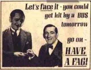
 "Someday all beer cans will open this easy!" Apparently, Schlitz pioneered the soft top aluminum can? This one isn't so much funny as it is nostalgic, to think that people had to use a can opener like the one shown here. I vaguely remember my parents, aunt & uncle using these kinds of can openers for stuff like V-8 juice.



 South Lake Tahoe, CA, where we stayed, is a tourist trap of epic proportions and bumper-to-bumper traffic. It's crowded and icky and I'm surprised that they let it get so out of control. Stateline, NV has all the casinos, and they are literally built right on the state line. But because of the beautiful natural setting, they're not all glittery and lit up like Vegas or Reno.


 The water looks delicious and tropical doesn't it? Ha! THINK AGAIN! Tahoe is an alpine lake and sits at an elevation of 6,200 feet. Yeah, people swim at S. Lake and Stateline, but after you wade in above your knees, you'll find your legs & feet starting to freeze and turn blue. I don't mind cold water, having grown up on the freezing cold Bay side of Cape Cod, but this was even too much for me. When I went with Brian, it was still so hot, and I plunged into the lake, yelped from the shock, dunked and then ran out!! The blue parts of the water look like Aqua Velva Ice Blue aftershave.


 Emerald Bay.


