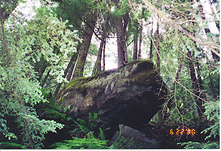
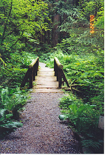
Washington State is home to the lower 48's only rainforests. When Michelle and John came to visit us in 2000, we just didn't have the time to drive the nearly 200 miles out to the Olympic Peninsula to see the large Hoh and Quinault Rainforests. However, there is a small rainforest trail at the Carbon River entrance to Mt. Rainier National Park, and that's a good one to show visitors when you can't get out to the Oly Pen.
 Since Michelle's pictures of the forest came out much better than mine, the ones with the date stamp on them in red are hers.

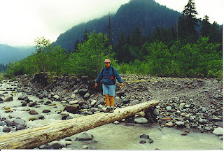
 After we left the rainforest trail, we drove farther down the road so that we could hike to Chenuis Falls, on the other side of the Carbon River. It was late June, and we'd had a very dry winter, so the Carbon wasn't as swollen and rushing as it is normally. Otherwise we never would have been able to cross it. And the only way to cross the river is on log bridges. These are long gone now, and the flood damage that exists in this area is of epic proportions. This was the first one we crossed. It was narrow, but it had a rail.
 Here Michelle is about to execute a cartwheel, flip, double twist and dismount. lol As you can see, there was no rail on the second log bridge, but fortunately the river was not deep or running swiftly enough to carry you away. The most you'd get is bruised from the rocks and wet feet.
 There's John, sizing up the last log bridge, which had a wire to hold onto. I would not have wanted to fall into this particular channel as it was deep and fast. The river is filled with silt and minerals, which is why it's so cloudy.
 It would be nice if they can fix the road so that we can access this part of the Park again, as it's the most remote corner of Mt. Rainier. However, it seems that all the repair funding is being channeled into repairing the buildings and trails at the visitor centers at Sunrise and Paradise, and reopening scenic Stevens Road, which has been closed for over a year now. It doesn't help that the other day we had another windstorm and a gust of 119 mph was recorded at Camp Muir, high on Mt. Rainier, so there is no doubt further damage to the Park.


 This green pool looked so delicious that I was fighting the urge to plunge in. But the water was icy cold because it was pouring off The Mountain, and it was not a very warm day.
Gorgeous! Reminds me of a trip I took in Canada on something called 'The Road to the sun'. I went through an entire roll of film in about 10 minutes.
ReplyDeleteI've been in Washington 20 years now and have never made it to the rain forests--it's on my list. I had no idea there was a more local version--will have to drag the kids out there one of these days.
ReplyDeleteKristy - Take 410 into Buckley, then on the right is the road that branches off thru Carbonado and Wilkeson, and that will get you to Carbon River entrance of the park. But you might want to call first and see if it's even open.
ReplyDeleteWhat a beautiful place, I love the pacific northwest. The first four pictures remind me of the Arboretum in Seattle.
ReplyDeleteTess - Don't you owe your brother a visit? hint hint ;P
ReplyDeleteTemperate Rainforests rule! There's nothing more soothing and calming.
ReplyDeleteYou have so MUCH scenery!
ReplyDeletewow, those are such beautiful pictures! i cant wait until i can afford to really travel. i have some st louis pictures that really need to be uploaded, but that's nothin compared to your vacations!
ReplyDeleteLaurel, this wasn't our vacation, these pics were taken less than 20 miles from ou house.
ReplyDeleteTruely beautiful and very well described. The scale is incredible.
ReplyDeleteWonderful photos! You gotta love the spectacular stuff that's within a drive of a few hours. I can get to the southern end of Great Smokies NP in about three, and I love that "the most visited NP" has but a small fraction of those visitors going into the backcountry. I'll bet there are tons of places like that in the Pacific NW.
ReplyDeleteI'm playing catch up, so here I am dropping by to say Hello :-)
ReplyDeleteThese pics are really beautiful, Jo, they make me miss the trips I used to have with my friends...
Homesick... *sniff sniff*
I lovelovelove this part of the country. So beautiful!
ReplyDeleteYou KNOW this is my favorite kind of nature, right?
ReplyDeleteIt is soooo beautiful...
And IMO, the cloudy weather makes it all more stunning, because the sun has a way of dampening the sharpness of the colors.
Thanks for the beautiful piccies, J!
i just luv it when you get your photo albums out!!
ReplyDeletethanks for sharing the
ReplyDeletebeauty of where you live
I don't think I would ever
want to leave such a place
hi jojo~i tagged you, over at my blog. hope that's okay-by-you.
ReplyDelete